

With the help of volunteer mappers and the Batangas Public Information Office, Google Philippines has made a map of evacuation centers regarding the Taal Volcano eruption. Read more in our articles including "Google launches Taal Volcano Eruption Crisis Map" and "Garmin CIRQA Smart Band now available in the Philippines".
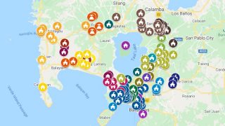
With the help of volunteer mappers and the Batangas Public Information Office, Google Philippines has…
Jan 16, 2020
Garmin has officially launched the CIRQA Smart Band in the Philippines, expanding its lineup of…
Jul 27, 2026
Infinix has launched the XBUDS H5 in the Philippines, expanding its lineup of affordable true…
Jul 27, 2026
Samsung has unveiled its first intelligent eyewear, expanding the Galaxy ecosystem beyond smartphones and wearables…
Jul 27, 2026
What’s new in Geekbench 7 New media workloads for AV1 video encoding, Opus audio compression,…
Jul 27, 2026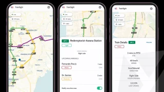
A new app called TrainSight aims to make commuting in Metro Manila more convenient by…
Jul 27, 2026With the help of volunteer mappers and the Batangas Public Information Office, Google Philippines has made a map of evacuation centers regarding the Taal Volcano eruption.
Our coverage of Taal Evacuation Centers includes: "Google launches Taal Volcano Eruption Crisis Map"; "Garmin CIRQA Smart Band now available in the Philippines"; "Infinix XBUDS H5 now available in the Philippines". Each article provides unique insights and information.