
The Department of Science and Technology – Philippine Institute of Volcanology and Seismology (DOST-PHIVOLCS) will present a new technology product dubbed as Spectral Acceleration Maps of the Philippines (SAM PH) Atlas. According to the DOST-PHIVOLCS, the SAM PH Atlas is capable of helping engineers in the creation of earthquake-resilient infrastructures, particularly in high-risk areas. As per the DOST-PHIVOLCS, the SAM PH Atlas supports the Build! Along with the Earthquake Model Atlases for the Philippines, Metro Manila, Metro Cebu, and Metro Davao published from 2018 to 2019, the SAM PH Atlas will also provide science-based information for urban development, risk assessment, and site-specific insurance rates and coverages. "We firmly hope that this latest atlas will be utilized by all stakeholders for decision-making in building safer structures and facilities and for strengthening the resiliency of our communities," said DOST Undersecretary and PHIVOLCS Officer-in-Charge Renato U. The Atlas maps also contain maps of historical earthquakes from 1619 to 2015, active faults, and trenches in the country. A digital copy of the atlas will be made downloadable for free on the DOST-PHIVOLCS website. The launch and turnover of SAM PH ATLAS from DOST-PHIVOLCS to the Department of Public Works and Highways (DPWH) and the Association of Structural Engineers of the Philippines (ASEP) will be held tomorrow, March 23, at 9 AM via Zoom. Read more in our articles including "DOST-PHIVOLCS to launch SAM PH Atlas to aid in designing earthquake-resilient structures" and "Microsoft extends Windows 10 lifespan for another year... again".
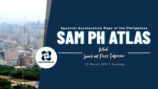
The Department of Science and Technology – Philippine Institute of Volcanology and Seismology (DOST-PHIVOLCS) will…
Mar 22, 2021
Despite Microsoft’s aggressive push to transition users onto Windows 11, a massive chunk of the…
Jun 26, 2026
Marking its 10th anniversary alongside National ICT Month, the Department of Information and Communications Technology…
Jun 26, 2026
After the teaser video released recently, we’ve finally seen what the Nothing Phone (4b) will…
Jun 26, 2026
The Philippines is stepping up its digital defenses with a new centralized hub designed to…
Jun 26, 2026
We’ve written about it in May, but we’re happy to report that the HUAWEI Watch…
Jun 26, 2026The Department of Science and Technology – Philippine Institute of Volcanology and Seismology (DOST-PHIVOLCS) will present a new technology product dubbed as Spectral Acceleration Maps of the Philippines (SAM PH) Atlas. According to the DOST-PHIVOLCS, the SAM PH Atlas is capable of helping engineers in the creation of earthquake-resilient infrastructures, particularly in high-risk areas.
As per the DOST-PHIVOLCS, the SAM PH Atlas supports the Build! Along with the Earthquake Model Atlases for the Philippines, Metro Manila, Metro Cebu, and Metro Davao published from 2018 to 2019, the SAM PH Atlas will also provide science-based information for urban development, risk assessment, and site-specific insurance rates and coverages. "We firmly hope that this latest atlas will be utilized by all stakeholders for decision-making in building safer structures and facilities and for strengthening the resiliency of our communities," said DOST Undersecretary and PHIVOLCS Officer-in-Charge Renato U.
Our coverage of ATLAS includes: "DOST-PHIVOLCS to launch SAM PH Atlas to aid in designing earthquake-resilient structures"; "Microsoft extends Windows 10 lifespan for another year... again"; "DICT launches "eGov App on Wheels" for remote, hard-to-access areas". Each article provides unique insights and information.